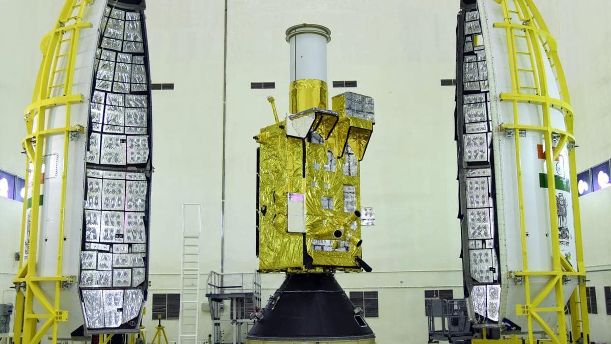
ISRO Banks on GISAT-1A Launch to Break String of Recent Rocket Failures
The GSLV-F17 rocket is set to carry the geostationary imaging satellite into orbit from Sriharikota, a mission that doubles as a second attempt at a satellite India lost in 2021 and as a chance to reset a launch programme rattled by two straight PSLV failures.
The Indian Space Research Organisation is preparing to launch its GISAT-1A satellite aboard the GSLV-F17 rocket from the Satish Dhawan Space Centre in Sriharikota, a mission carrying weight well beyond the roughly 2,367 kilogram spacecraft it will carry into orbit. The launch also marks a second attempt at placing a geostationary imaging satellite in orbit after the original GISAT-1 was lost in 2021, and comes at a moment when ISRO is looking to arrest a run of setbacks in its launch programme.
That 2021 failure saw the GSLV-F10 rocket's first two stages perform as expected before its cryogenic upper stage failed to ignite, the result of a leaking valve that let pressure escape from the liquid hydrogen tank and left the satellite stranded without a path to orbit. GISAT-1A effectively rebuilds that mission from scratch, giving India another shot at the capability the original satellite was meant to deliver.
The stakes around this launch have only grown given ISRO's more recent troubles. Two PSLV missions failed in succession, with the rocket carrying EOS-09 going down in May 2025 and another carrying N1 failing in January 2026, both traced to the third stage nozzle throat material giving way, first an imported graphite insert and then a carbon composite substitute used in its place. A clean GISAT-1A launch would offer a visible signal that those design and manufacturing issues have been addressed.
Once in geostationary orbit roughly 36,000 kilometres above Earth, GISAT-1A is designed to deliver a kind of coverage India has not had before, imaging selected high priority regions as often as every five minutes and sweeping the entire Indian landmass about every thirty minutes at a spatial resolution of 42 metres. The satellite carries a 700 millimetre Ritchey-Chretien telescope paired with sensors spanning multispectral and hyperspectral bands, giving it the sensitivity to track fast changing conditions on the ground almost as they happen.
That near real time view is expected to feed directly into disaster response, letting agencies track cyclones, monitor flooding and spot forest fires as they develop rather than after the fact, while also supporting precision agriculture, snow and glacier monitoring, oceanographic research and border surveillance. For ISRO, success would mean recovering both a lost capability and a measure of confidence in a launch programme that has had little room for further setbacks.